
It could be called “The Bike Trail to Nowhere.”
A 1.3-mile section of Pierce County’s scenic Foothills National Recreation Trail is paved, bridged and waiting for cyclists, hikers and horse riders. There’s just one hitch — there’s no good way to get to it.
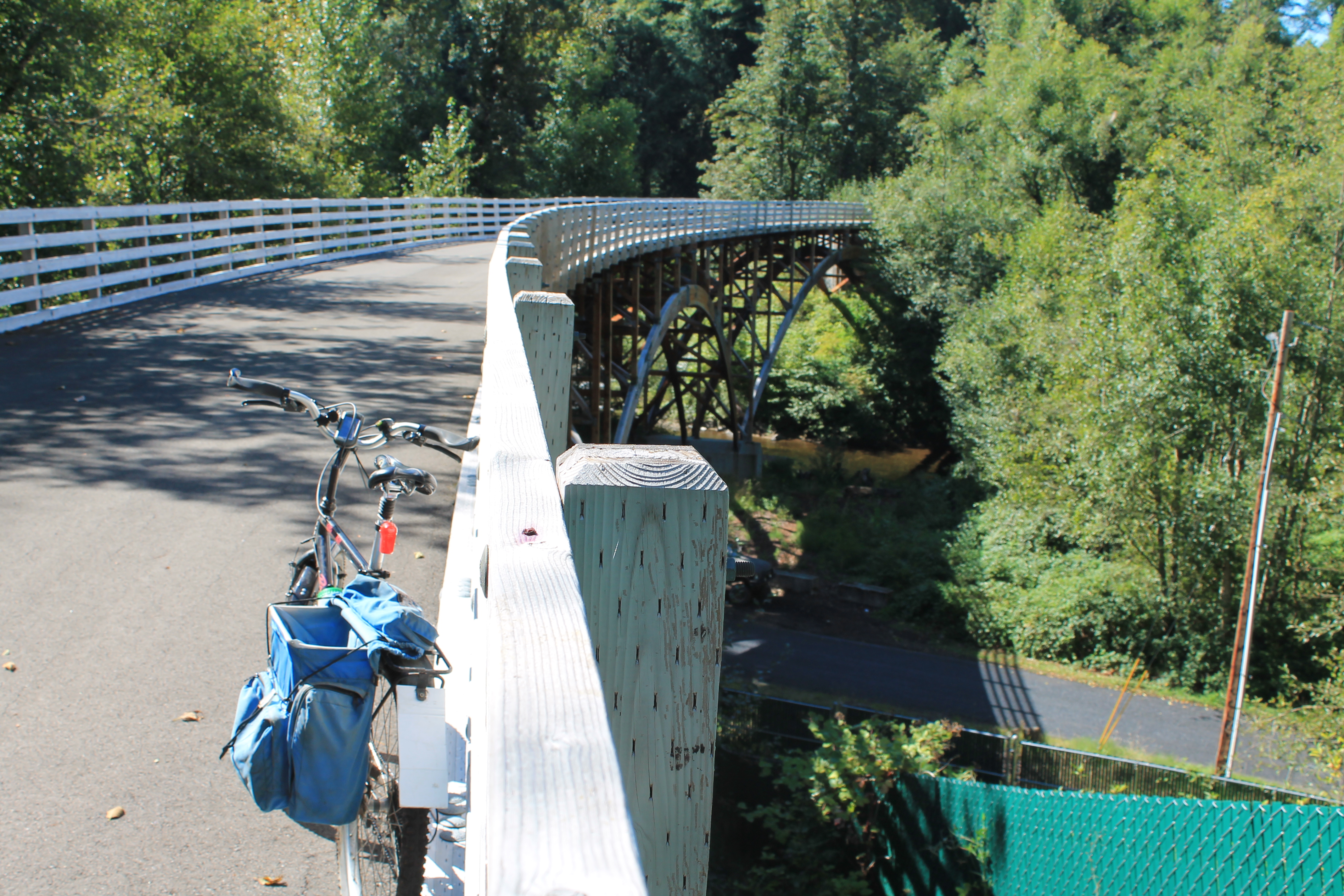
View from “trail to nowhere” bridge on Foothills Trail
Access from the trail in South Prairie in the west is blocked by private property. Access from the trail in Buckley in the northeast requires a perpetually muddy slog through a swamp.
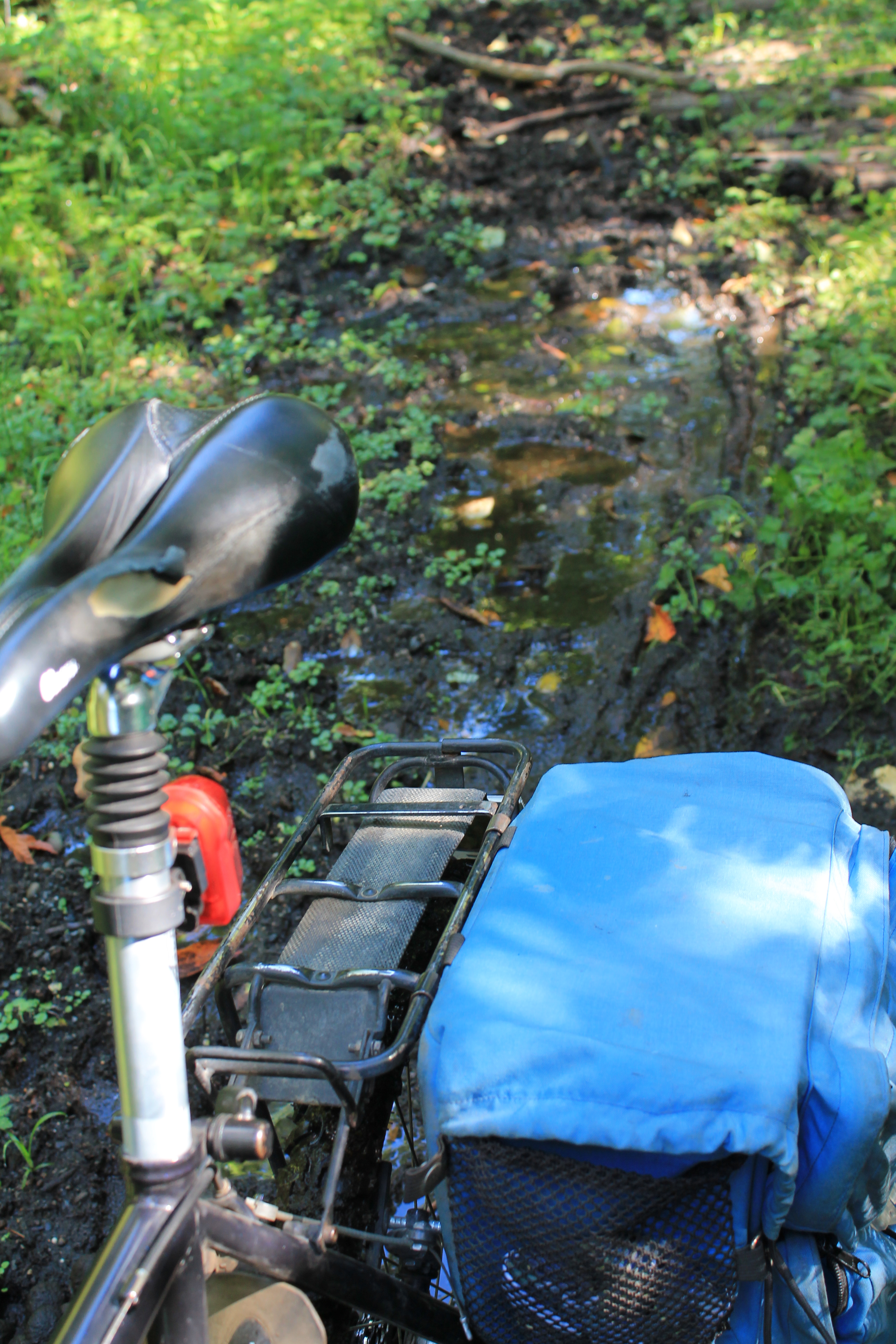
Soggy trail is only access
Gaining access
Pierce County is currently trying to remedy that problem on two fronts, which would result in 2.3 miles of paved connecting trail.
The county has applied for a state grant of $2.7 million to help pay for the estimated $5.5 million to build connections to this “Nowhere Trail” from existing sections of the Foothills Trail. We’ll know whether the county will receive the entire grant when the state legislature approves the budget next year.
Last week, the county council also launched condemnation proceedings to gain ownership of the last 4 properties that block those connections. See “Pierce County will condemn properties …. “
If the condemnations go through, and the funding is secured, the three separated sections of trail could be connected in a couple of years. Joseph Coppo, Pierce County parks and recreation planner, said the earliest would be 2017.
It would mean a trail from Puyallup to Buckley, a distance of some 20 to 25 miles.
[Update: Dec. 29, 2014 — Fallen tree knocks down Foothills Trail bridge, complicating connection plans]
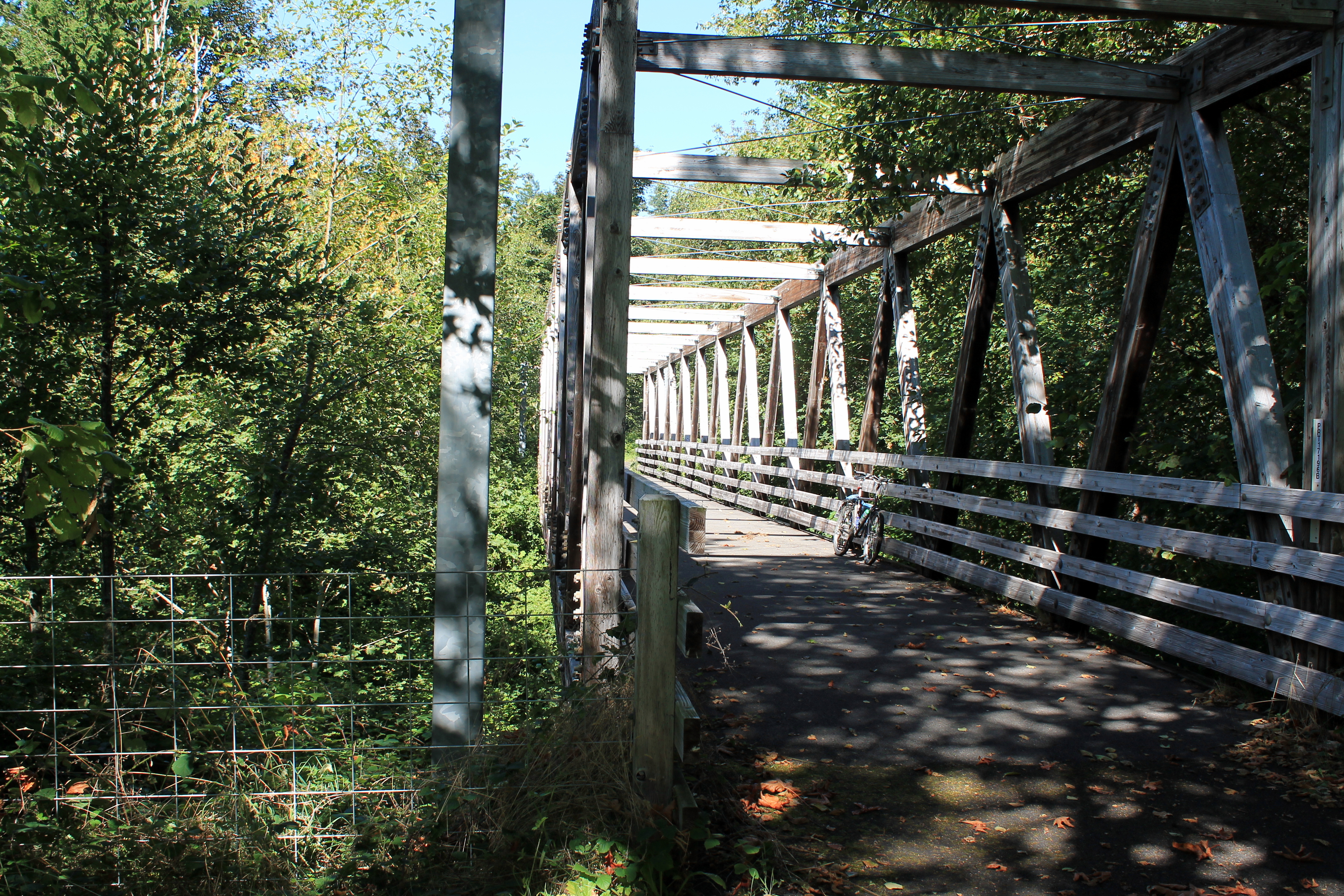
1st bridge on orphaned section
Limited access
Those who ride the 15-mile trail from Puyallup, through Orting to South Prairie are no doubt familiar with the gate and no trespassing sign where the old Burlington Northern Railroad right-of-way enters private property.
Last year, the county acquired some of that private property from the owner of a trailer park. He has a two-year lease to continue his business while the county acquires the right-of-way from the other hold-outs.
Another entrance, from Buckley, was recently acquired from a private property owner. This section of right of way is muddy year-round, even in the fall. But if you want to see this piece of railroad history where the tracks formed a bow-tie to gain elevation to the Enumclaw plateau, that’s the only way in.
Another bridge in the “bow-tie” railroad grade
Riding the Trail to Nowhere
I’ve taken the bait a couple of times and slogged through the muddy bog from the Buckley side. The trip in May called for hefting the bike through ankle-deep mud; the summer-long dry weather hadn’t improved conditions much by September.
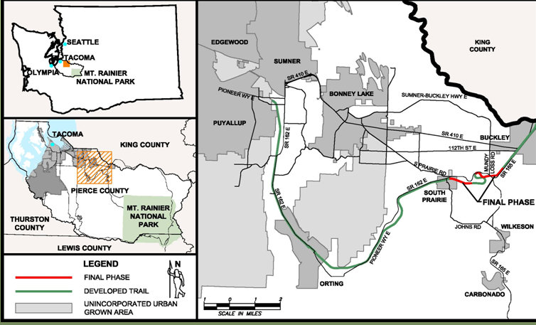
Locator map; click for closer view — Pierce County
If the project is funded, the county plans to put wooden walkways through here to elevate the trail above the muck.
I’m told that the Northern Pacific Railroad (later to become the Burlington Northern) first came through here beginning in 1887 as it laid tracks from Tacoma to St. Paul, Minn. Railroad designers had to figure a way to gain elevation in the short distance between South Prairie and Buckley. They hit on the idea of massive switchbacks — called a “bowtie” by some — to reduce the grade for trains climbing out of a canyon formed by Wilkeson Creek (South Prairie Creek) and its tributaries.
Heading south from Buckley, the trail becomes packed dirt after the bog and suddenly emerges onto a 12-foot-wide paved trail at the intersection with a private road. (Don’t even think about using this private road.)
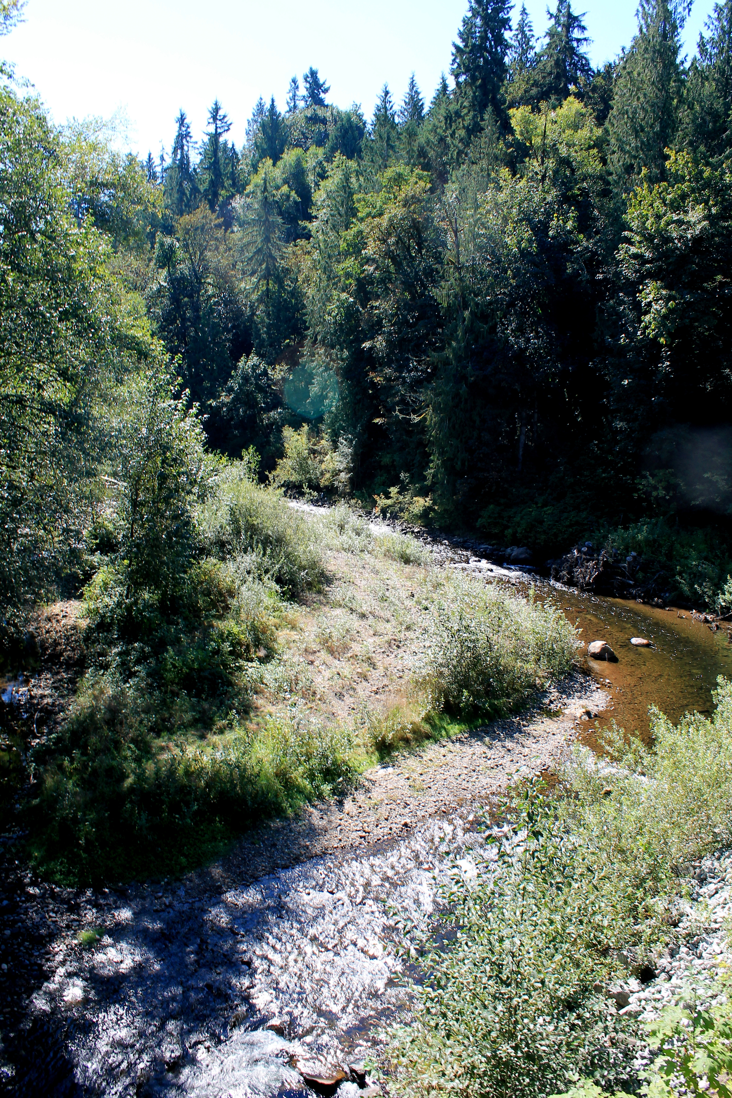
View of Wilkeson (South Prairie) Creek from bridge
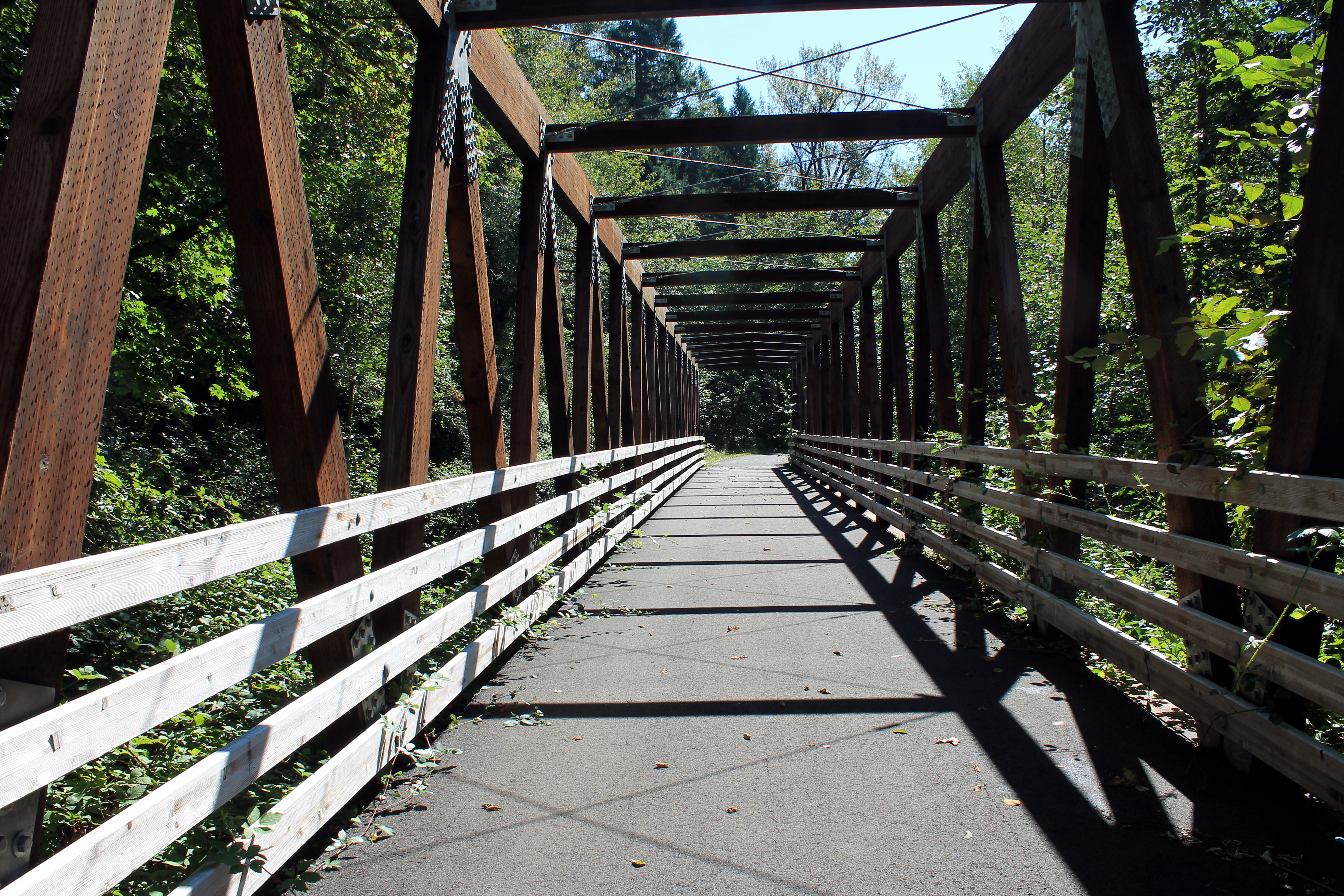
Apparently the county had title to this section of property and decided to go ahead and build it. Funds from the federal, state, and county, as well as the Foothills Rails to Trail Coalition, went into paving this 1.2-mile section with its four bridges.
It’s kind of eerie to ride along this paved trail that almost never sees visitors. A couple of dried piles of horse poop were the only indication I saw that anyone had been back in here. Not even the carpet of moss over the shady sections of trail had any tire marks.
There is one spot with a view of Mount Rainier’s summit, but the bridges offer the most dramatic scenery. One long curving bridge passes over both the rural Lower Burnett Road East and Wilkeson Creek.
After passing a large swamp on the left and the fourth bridge (again over Wilkeson Creek) the trail ends at a No Trespassing sign. The easiest and safest (and muddiest) way out is to return the way you came.
Opening this section will not only gain access to South Prairie, but also the Cascade Junction which diverted trains up the mountain toward Wilkeson.
Grant
Let’s keep our fingers crossed that these condemnations get through the courts and Pierce County gets its needed funding from the Washington Recreation and Conservation Office. It ranked number 8 out of 20 projects, and would get fully funded if the state approves $75 million to RCO in 2015.
Funding this project would provide a big shot in the arm to businesses in the small towns that sit along the trail, including Orting, South Prairie and Buckley. For instance, a coffee kiosk in South Prairie that has set up benches and tables for cyclists on the trail usually gets more business from trail-users than motorists during summer months. I’m sure lots of merchants would like to see this kind of traffic.
More details on Foothills Trail land condemnation action by Pierce County
See map in detail
4 comments
2 pings
Skip to comment form
Getting into remote places is like adventure hunting. You suddenly start feeling like Indiana Jones and can go on exploring anything without any disturbance.
I just checked it out in detail myself. There were either mountain bike or dirt bike tire tracks on the unpaved upper section when I trudged through the mud.
Author
After the recent rains, I would imagine that “entrance” section on the Buckley side was plenty muddy. Nice photos. Did you capture that view of Rainier from the trail or someplace nearby?
Yeah, it was muddy. I had to push my bike through it, but thank goodness dirty rims don’t affect disc brakes.
Glad you liked the photos. That photo of Rainier was from ‘268th Avect E,’ that gravel road that terminates the paved section on the upper side.
[…] Gaining access to orphaned section of Foothills Trail in Pierce County » Biking Bis […]
[…] See also: Gaining access to an orphaned section of Foothills Trail in Pierce County […]