
Oregon Department of Transportation Columbia River Gorge Bike Map — Produced by the state of Oregon, it offers three routes along the scenic Columbia River Gorge: Historic Columbia River Highway; State Route 14; and Interstate 84. Longest distance, Portland to The Dalles, is 84 miles.
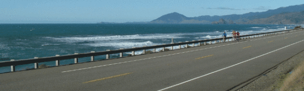
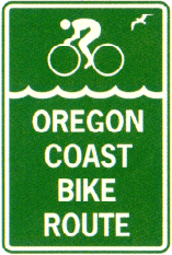 Oregon Coast Bike Route Map — Detailed state map of entire 370-mile bike route along the Pacific Coast in Oregon; total rise and fall is 16,000 feet. Due to prevailing winds, north to south cycling is recommended. Includes list of campgrounds.
Oregon Parks and Recreation Department
Willamette Valley Scenic Bikeway Route — Online map (for download) of 130-mile bike route from Champoeg State Park (south of Portland) to Armitage County Park (north of Eugene).
Prairie City area bike rides — Elevation charts, maps and cue sheets for 24 bicycle rides around Prairie City in eastern Oregon.
2005 Livestrong cancer bike ride (all begin in Beaverton)
10-mile and 40-mile bike route sheet — Relatively flat; passes near Tualatin Valley Nature Park and wine country.
70-mile bike route sheet — Rolling hills; lakes and wine country (also download 40-mile circuit)
100-mile bike route sheet — Mountainous; steep climbs at Mountain Home (800 feet) and Bald Peak (1,600 feet). Also download 40-mile circuit.
Recent Comments