
I’ll be the first to admit that I’m a sucker for maps, especially older ones. Sometimes I think that’s one reason I like to explore by bicycle — it gives me a chance to follow those blue lines on a map at a snail’s pace.
So you can imagine my reaction when the Mountains to Sound Greenway Coalition published this circa 1928 Department of Public Works map of western Washington. The predominant form of transportation on this map is the railroad.
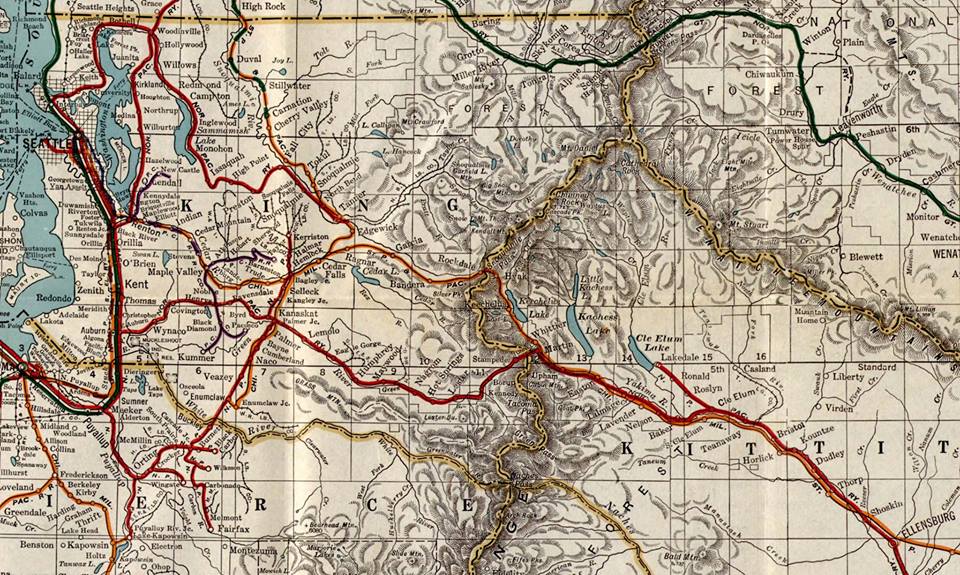
Dept. of Public Works map from 1928 Washington state
Consider that the first white settlers arrived in the Seattle area only 76 years before this map was created. Washington state was just admitted to the union in 1889.
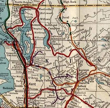
King County detail of 1928 map
The main way to ship goods in those days was by railroad or boat. Heck, in 1928 the first motorcar route over the Cascades had only been open for about a dozen years.
Rails to trails
Here’s another view of that map, showing the western part of King County.
The railroads become clear, as does the fact that many survive today as rail-to-trail conversions. Essentially, the person who made this map in 1928 also made a blueprint for a bike trail network launched 50 years later.
Burke-Gilman
You can see where the old Seattle, Lake Shore and Eastern Railway rolled out of Ballard. At the north end of Lake Washington it heads southeast past Lake Sammamish toward Snoqualmie and ended just beyond North Bend.
Later sold to Northern Pacific, today that route comprises several rail trails — the Burke-Gilman, the East Lake Sammamish, the High Point-Preston and the Preston-Snoqualmie trails. The Burke-Gilman Trail was the first, established between Gas Works Park and Tracy Owen Station.
The Preston-Snoqualmie Trail ends one-mile shy of the town of Snoqualmie, but has an amazing view of Snoqualmie Falls. Between Snoqualmie and North Bend, it’s the route of the historical tourist train.
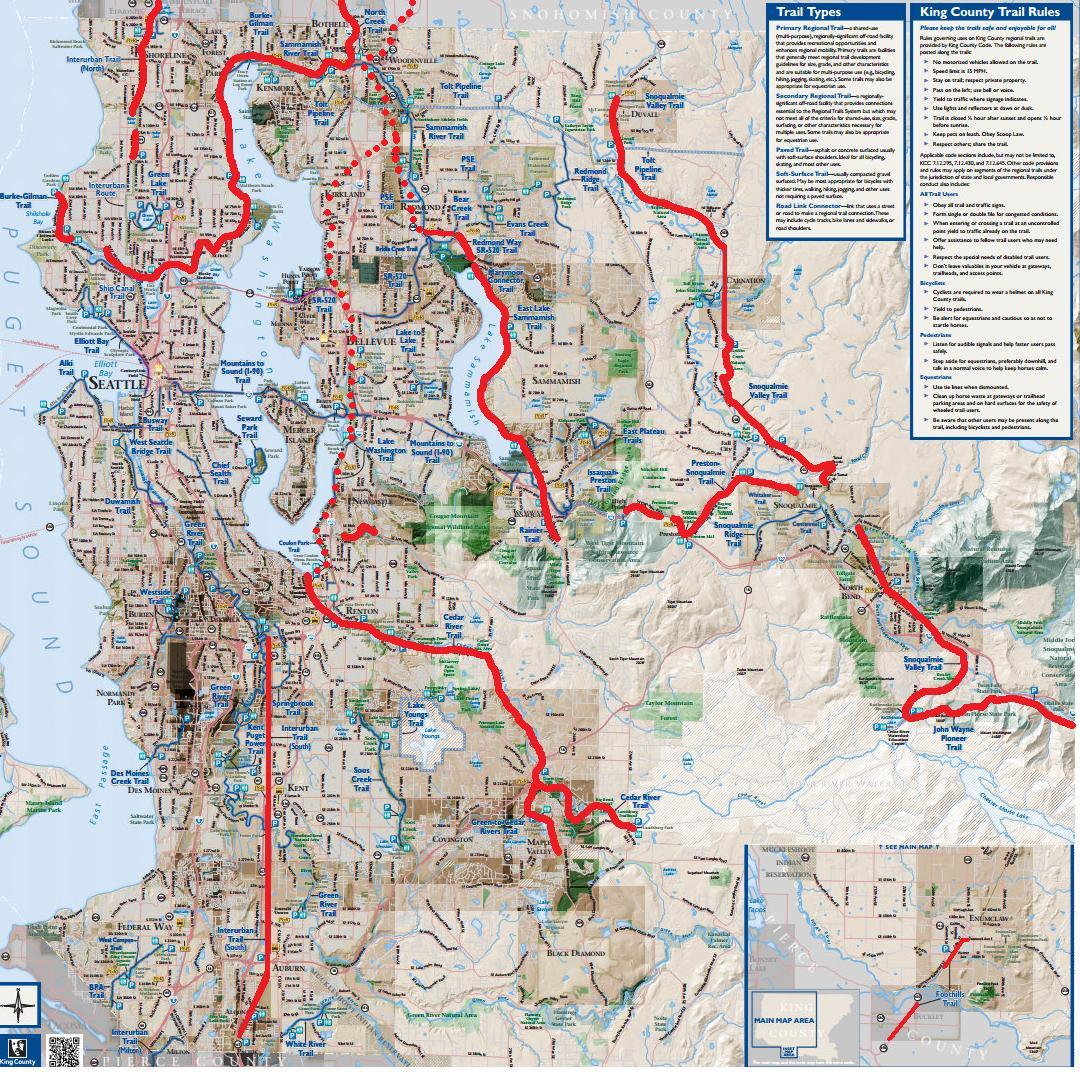
Rail trails on King County Bicycle map
Milwaukee Road
In Renton, you’ll find the Chicago, Milwaukee, St. Paul and Pacific Railroad following the Cedar River east toward Snoqualmie Pass. At Cedar Falls, a spur line heads north toward Everett.
Today that’s the Cedar River Trail between Renton and Landsburg. Between Landsburg and Cedar Falls, it’s a no-man’s-land closed to public access by the Seattle Public Utilities Department because it’s the drinking water supply for Seattle.
Beyond Cedar Falls, it becomes the John Wayne Pioneer Trail that crosses Snoqualmie Pass in a 2-mile tunnel and continues to the Idaho border.
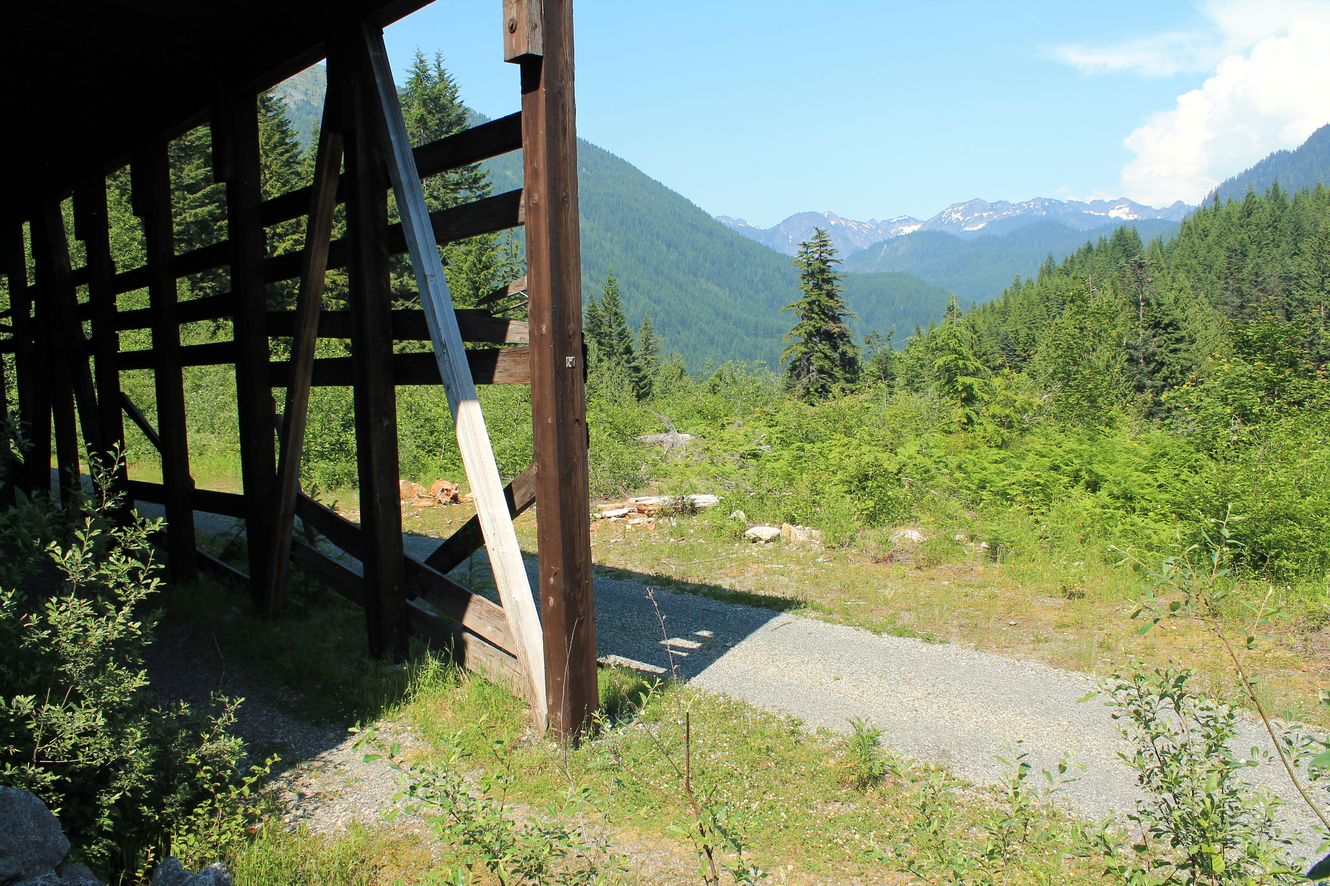
Snowshed on John Wayne Pioneer Trail
That spur line running north out of Cedar Falls is now the Snoqualmie Valley Regional Trail. It rolls downhill to North Bend then across the upper Snoqualmie Plateau almost to the town of Snoqualmie. There’s a detour off the old railroad route until it picks up at Tokul and heads all the way to Duvall. Plans are in the works to extend the trail north to Snohomish to join the Centennial Trail.
In Maple Valley, you’ll see a railway line in blue. The southern half is now the Green-to-Cedar Rivers Trail, which one day will connect those two rivers by path.
Eastside Corridor
The straight line running south out of Tukwila is the Interurban Railway to Tacoma, which is now the Interurban Trail that ends at Pacific. North of Seattle, the Interurban Trail runs north into Snohomish County.
On the east side of Lake Washington is the BNSF Railway’s right-of-way that was acquired recently. It’s visible in the bottom map as a dotted line and is now called the Eastside Rail Corridor. Kirkland already has laid claim to one section and is building the Cross Kirkland Corridor. Redmond is doing the same.
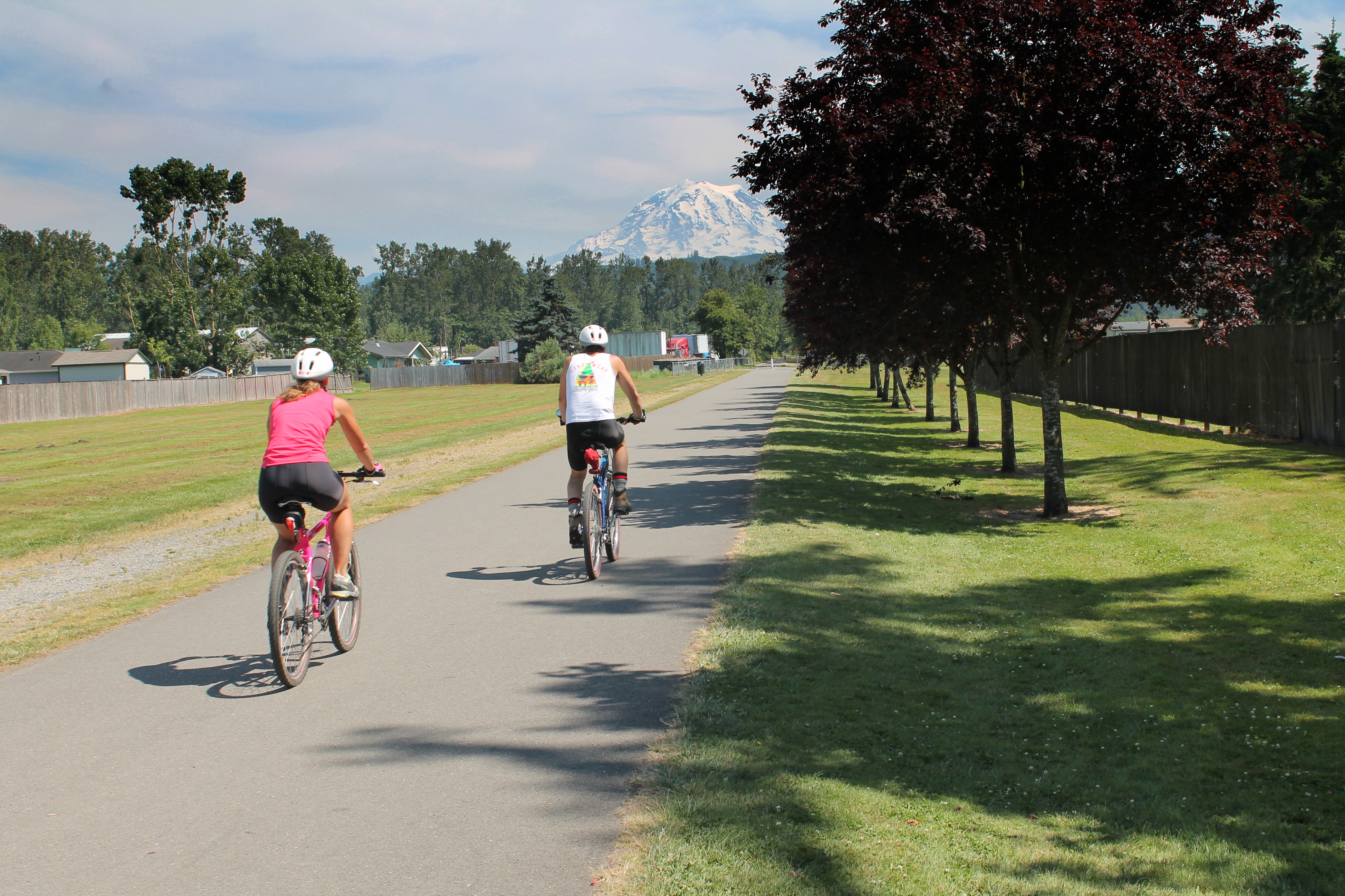
Foothills Trail in Orting
Long-range plans call for it to be a bicycle path along it’s entire length, although it will be shared by light rail and utilities in places.
In the map at top, you’ll also see the familiar outline of the Foothills Trail in Pierce County as it leaves Meeker station heading to South Prairie. Extensions of that trail to the east are being held up in landowner disputes. The future of those trails might be decided in the US Supreme Court in the Marvin M. Brandt Revocable Trust vs. the United States case involving a private landholder in Wyoming.
1 pings
[…] Vintage Washington map shows today’s rails-to-trail network » Biking Bis […]