
The long wait is over. Bicyclists can now take the paved Foothills Trail from the East Puyallup trailhead, through Orting and South Prairie, and into Buckley — a distance of 21 miles.
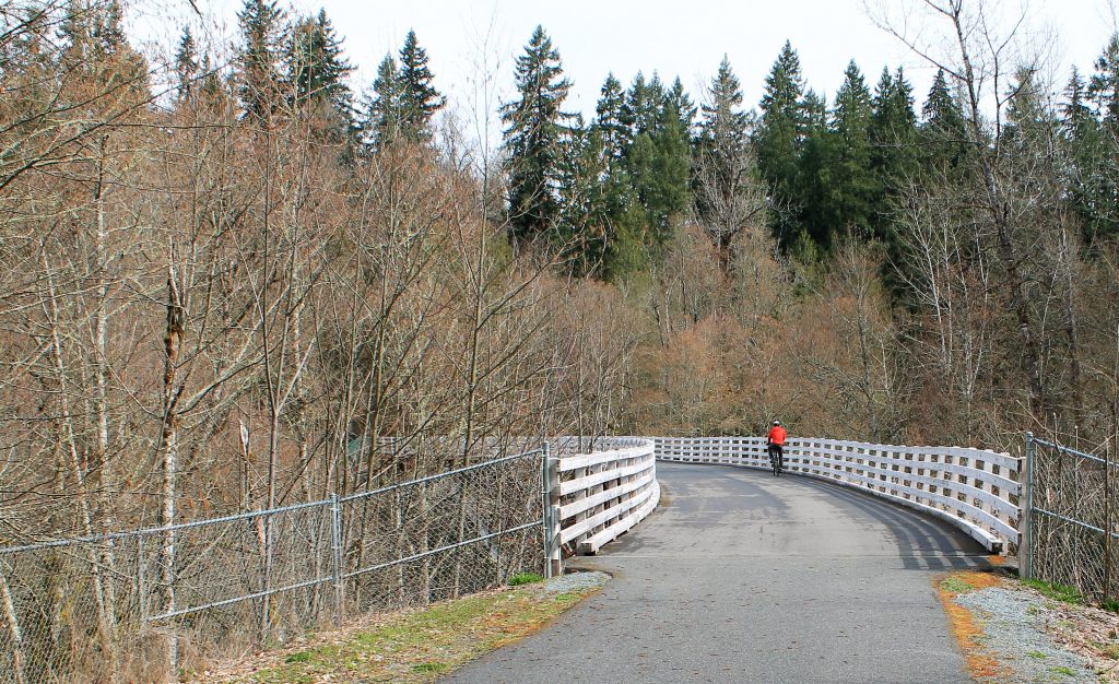
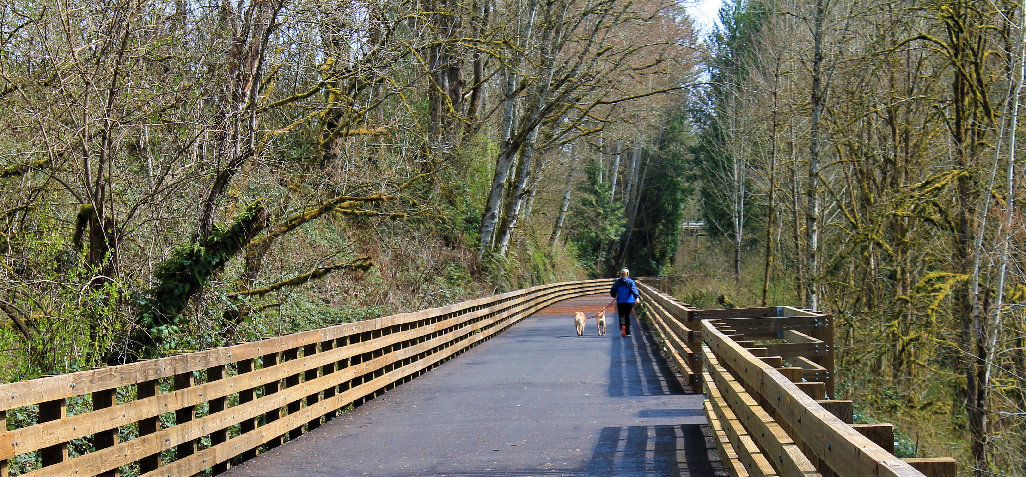
Bridge on newly opened section of Foothills Trail
The rail-trail rolls along the foothills of Mount Rainier, passing through old woods and farms and crossing over ice-cold rivers that drain glaciers on the active volcano. It connects the old railroad and lumber towns of Orting, South Prairie, and Buckley.
A friend and I met there this week to ride our bikes after hearing the news that the entire trail had opened. Crews that had been working on the eastern section of trail between South Prairie and Buckley had finished up recently.
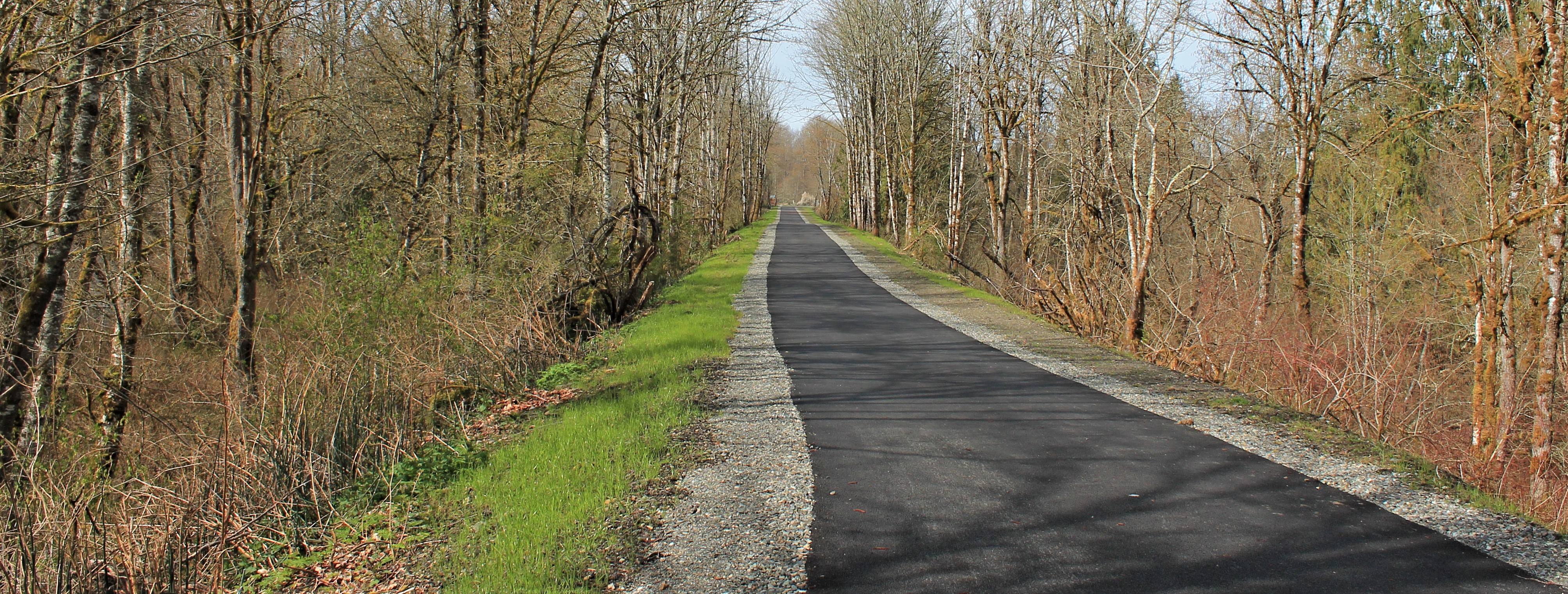
Fresh pavement on straight trail east of South Prairie
We rode the arguably most scenic 12.5 miles from Orting to Buckley. We had lunch at a circa 1905 diner on Main Street, and returned to the daffodil bell tower in Orting.
This is a smooth, wide path with room for pedestrians and bicyclists. The grade gains 600 feet as it climbs from Orting up to the Enumclaw plateau. It’s not steep enough to cause a sweat, but it puts speed under your wheels on the return trip.
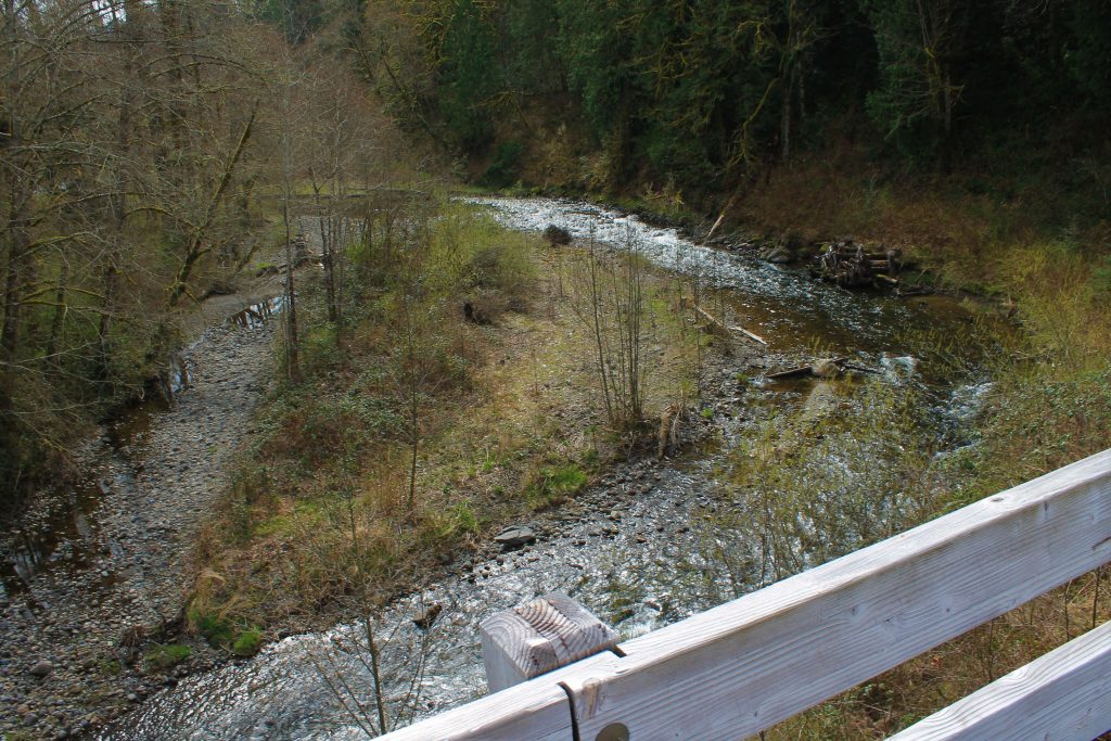
Hawk’s eye view of South Prairie River from newly accessed trail bridge
The sound of water in motion is everywhere. There’s a constant ripple from the Carbon River and South Prairie Creek as they splash over rocks and boulders. Drainages gurgle down steep terrain, sometimes not visible for the vegetation. Near Buckley, where earlier trail travelers used to get bogged down in the swampiness, a new wooden walkway carries bicyclists above the soggy ground. Water trickles down the walls of the adjacent railroad cut.
(more below map)
Northern Pacific
The Foothills Trail follows the corridor of the Northern Pacific Railroad, originally built in the 1870s to connect the lumber and coal mines at the foot of Mt. Rainier with Tacoma. It later crossed the Cascades as a transcontinental railroad. Abandoned in the 1980s, trail enthusiasts eventually organized the Foothills Rails to Trails Coalition to create the trail network that exists today. It has been a 20-year endeavor.
The rail-trail between East Puyallup and South Prairie has been a popular bicycling, hiking, and fishing destination for many years. Further east, a trail followed the railroad corridor through Buckley southward to a swamp.
In between, an “orphaned” section of trail could not be accessed because of private property issues on the South Prairie side and a swampy drainage on the Buckley side.
Lawsuits, property condemnations, and an infusion of state funds helped to open this section this past winter, extending the trail 6 miles from South Prairie to Buckley.
Future plans call for crossing the White River at Buckley to connect to the trail through Enumclaw to the north.
Starting in Orting, Mount Rainier dominates the view as you head east. In about a mile, the meandering Carbon River rushes along the trail. Leaving that behind at a trestle, you’ll soon pick up the somewhat tamer South Prairie Creek.
In about 7.7 miles you’ll reach the friendly trailside coffee stands in South Prairie, followed by a trailhead and parking.
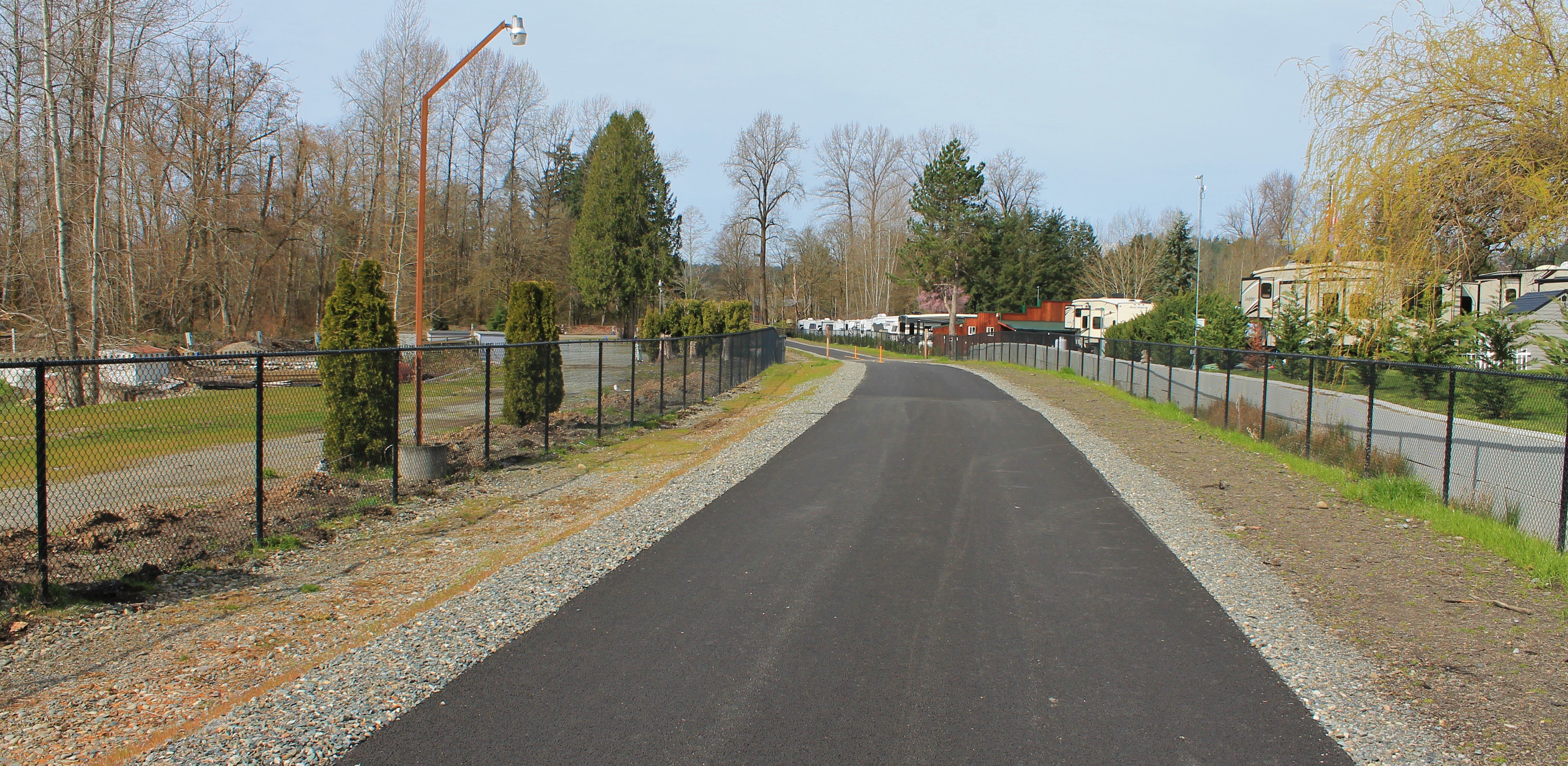
New trail through mobile home park that blocked access for years
This used to be the end of the trail. This week, we crossed the trestle and followed the trail through a mobile home park that once blocked access here. The trail now takes a wide right-of-way along the old railroad corridor through the mobile home park.
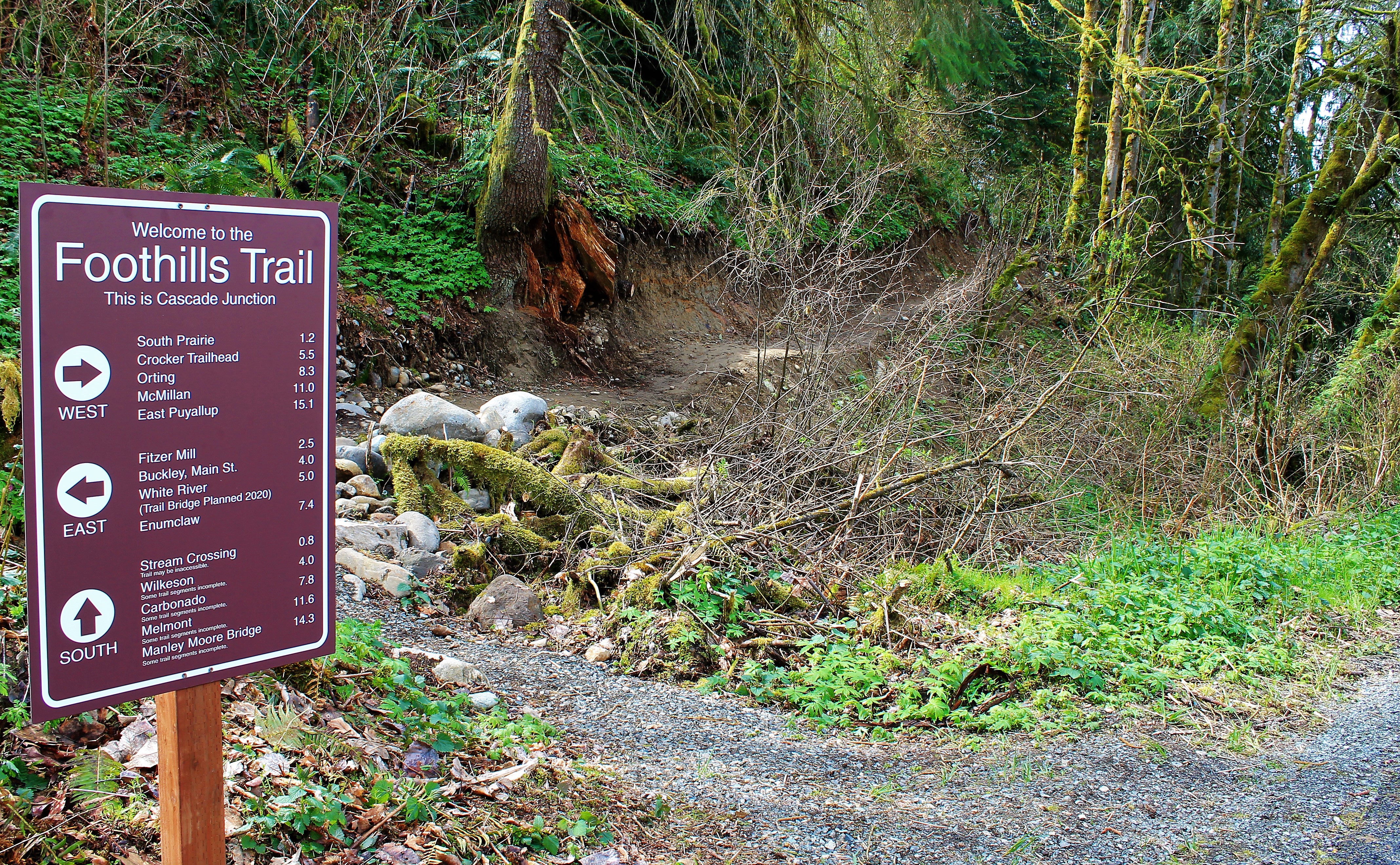
Less than a mile from the South Prairie trestle we passed through Cascade Junction, merely a point on a map and a signpost today. In 1888, it marked where the Northern Pacific tracks veered left from the old route to Wilkeson and headed over the Cascades.
Signpost marks the mountain bike trail south toward Wilkeson and Carbonado
A signpost marks the turn south toward Wilkeson on a dirt, mountain biking trail. This intermittent trail heads south for 14 miles to the Manley Moore Bridge near the Carbon River ranger station at Mount Rainier National Park.
Past the old junction, the trail crosses an embankment across a boggy area and then begins its climb up an area known as the “bowtie”. Railroad builders built massive switchbacks here to reduce the grade for trains climbing out of the South Prairie Creek canyon to the Enumclaw plateau.
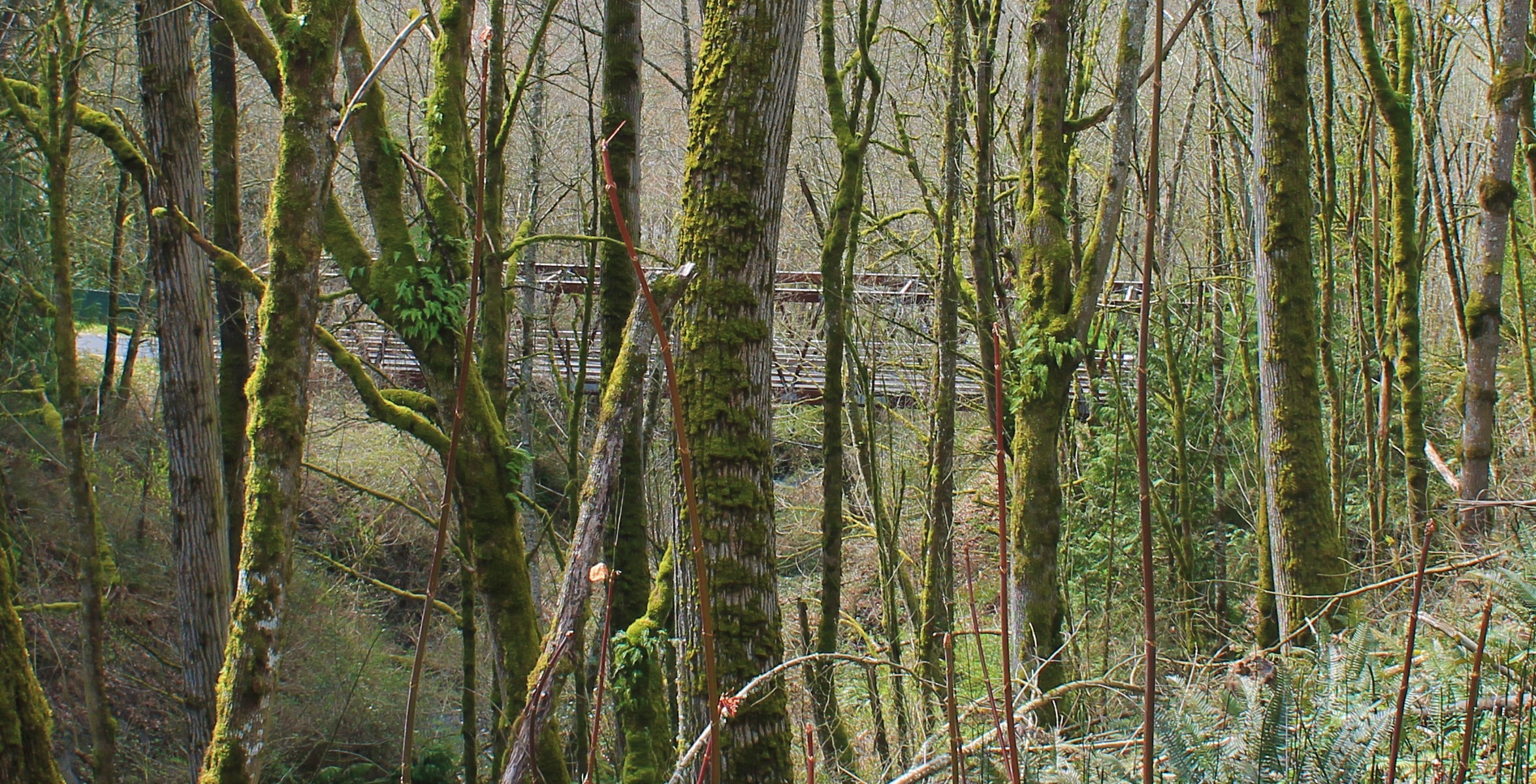
A previous trail bridge is barely visible through the trees from up the slope
We crossed two pedestrian bridges that crossed the canyon and noticed that the looping route doubles back on itself as it climbs out of the river valley. A third bridge, destroyed by a fallen tree a couple of years ago, has been replaced by a culvert and embankment across a low point.
Wooden causeway travels across a swampy area near Buckley
The trail crosses underneath SR 162 on a wooden causeway over a swampy area. This swamp proved a natural barrier to most trail users before this construction. Water seeps from the old railroad cut through here, and still collects in a ditch below where the tracks once passed.
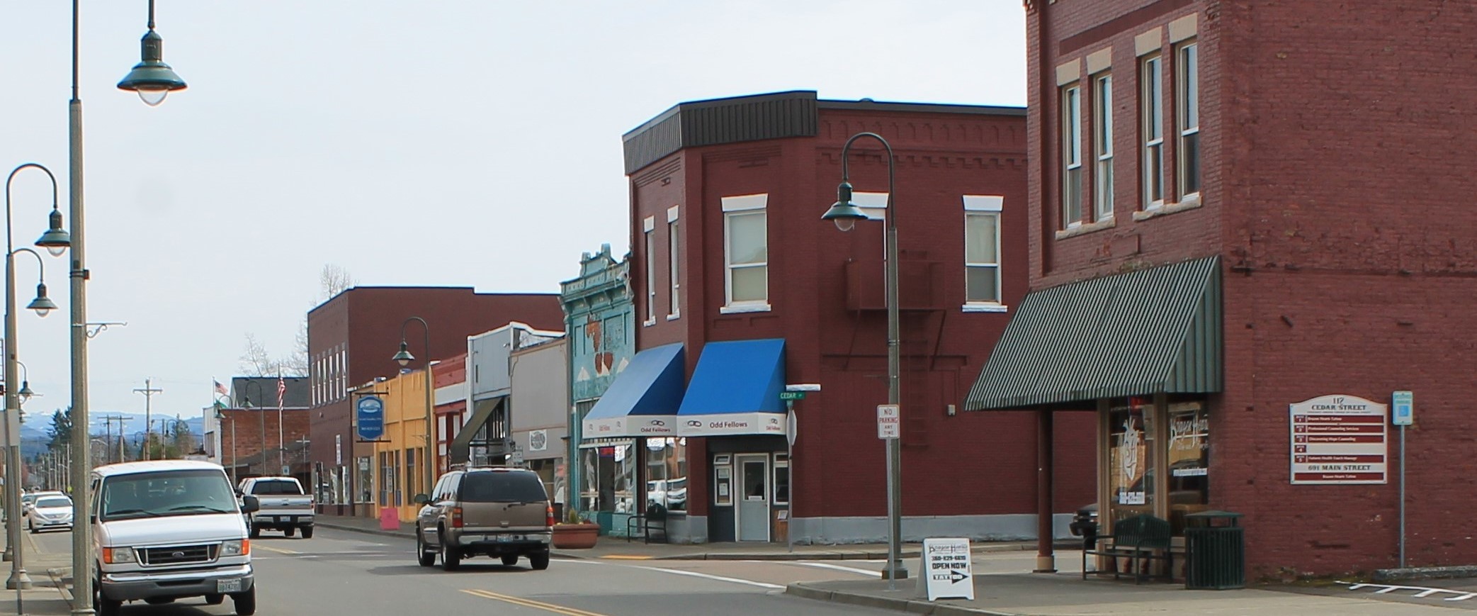
Main Street, Buckley, WA
In Buckley, the trail crosses a busy intersection and continues on wide sidewalks until it picks up the trail again through a park. It ends at the White River. We jumped off the trail at Main Street and picked up lunch at a burger and teriyaki diner.
Although the ride to Buckley wasn’t difficult, the return trip to Orting was a breeze as we dropped elevation.
What I enjoyed most about this ride was the remoteness of the trail set between two towns where you can find services and interesting diversions such as antique stores. Orting is known for its agricultural history and is home to an annual Daffodil Classic bike ride on April 8 this year. Buckley was once a logging center. Both towns still reflect that heritage.
We plan to return in drier weather to explore the side trail down toward Wilkeson and Carbonado.
Foothills Trail Celebration Ribbon Cutting
May 19, 2018
11 a.m.
Veteran’s Memorial Park in South Prairie
3 comments
I’m glad the trail is finally finished after years of struggle. I have read with interest how the completion was finally accomplished.
As a bike riding enthusiast the trail completion
will be exciting.
It’s wonderful trail it gets bikers off the busy highway’s more safer.
They are working on the White River bridge to connect to Enumclaw section of foothills trail.