
British Columbia free bicycle route maps
GREATER VANCOUVER
Greater Vancouver Transportation Authority — Nine maps show designated and alternate on-road and off-road routes through Vancouver and vicinity (all maps in .pdf format);
Greater Vancouver (west);
Greater Vancouver (east);
Vancouver, Burnaby, New Westminster, Coquitlam;
North Shore;
Port Coquitlam;
Pitt Meadows, Maple Ridge;
Richmond, Delta, Tsawwassen;
Surrey, Langley;
Surrey, White Rock.
 VANCOUVER ISLAND
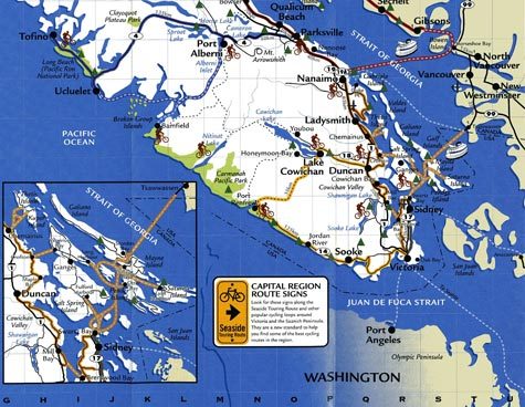
Centennial Trails — A network (under construction) of bicycle routes and trails around the municipality of Saanich. To be built in two phases, the first is scheduled of completion in 2006. Centennial Trails navigation map
Galloping Goose Regional Trail — Multi-use trail, formerly a railway line, moves through urban, rural and wilderness scenery on its 34-mile journey from Victoria to Sooke; Capital Regional District, Vancouver. Galloping Goose brochure (.pdf); Galloping Goose trail map only (.pdf)
Lochside Regional Trail — An 18-mile multi-use trail, formerly a railway line, stretches from Swartz Bay to Victoria, past beaches, farmland, and wetlands, down country lanes and beside suburban backyards; Capital Regional District, Vancouver. Lochside Regional Trail brochure (.pdf); Lochside trail map only (.pdf)
Sooke to Port Renfrew — A 46.5-mile one-way bicycle ride on narrow, hilly, shoulderless roads along the southern end of Vancouver Island along the Strait de Juan de Fuca. Route tip sheet only
— More to come —
British Columbia maps (not free)
Greater Victoria Cycling Map — Davenport Maps, Ltd.
South/Central Vancouver Island — Hike, bike, kayak; Davenport Maps, Ltd.
Vancouver Island Cycle Tourism Alliance — Source for bicycle maps, trail guides, and other resources for traveling to Vancouver Island.
Back to Biking Bis main page
Recent Comments