
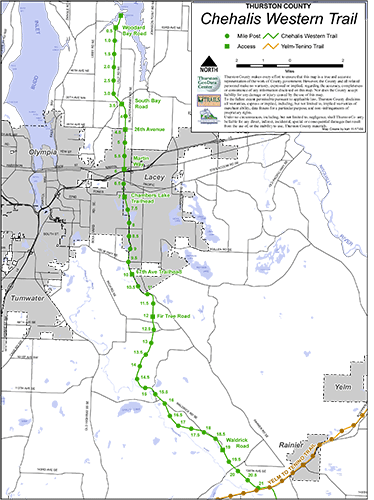
Bicyclists can ride the entire length of the 22-mile Chehalis-Western Trail in Thurston County now without mixing it up with road traffic in downtown Lacey.
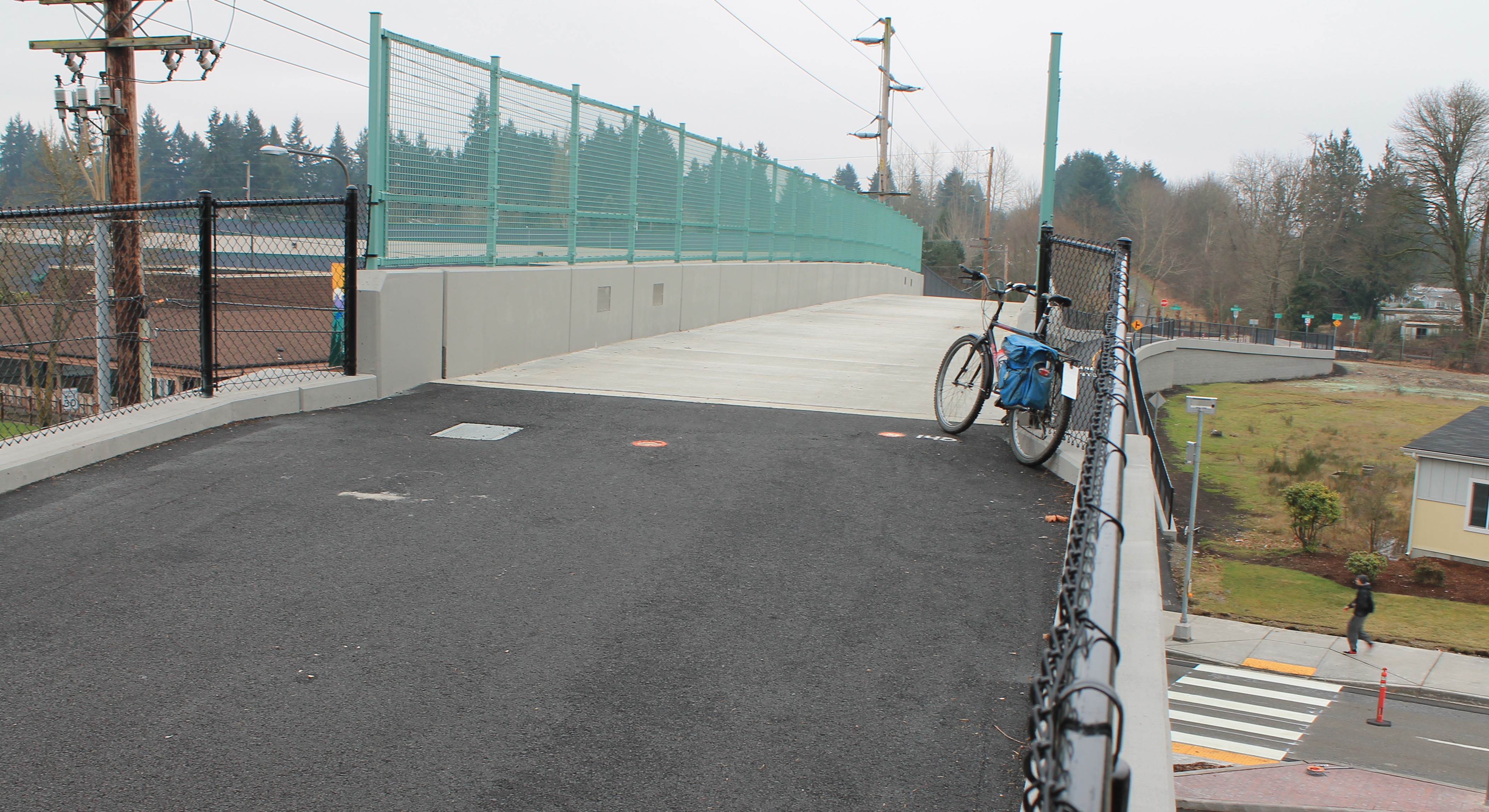
New bike bridge over Pacific Avenue in Lacey
The third span in the three-bridge project in Lacey was completed ahead of schedule in December.
The bridge over Pacific Avenue closed the last gap on the rail-trail that rolls from Woodard Bay on the Puget Sound in the north to the junction with the Yelm-Tenino Trail in the south.
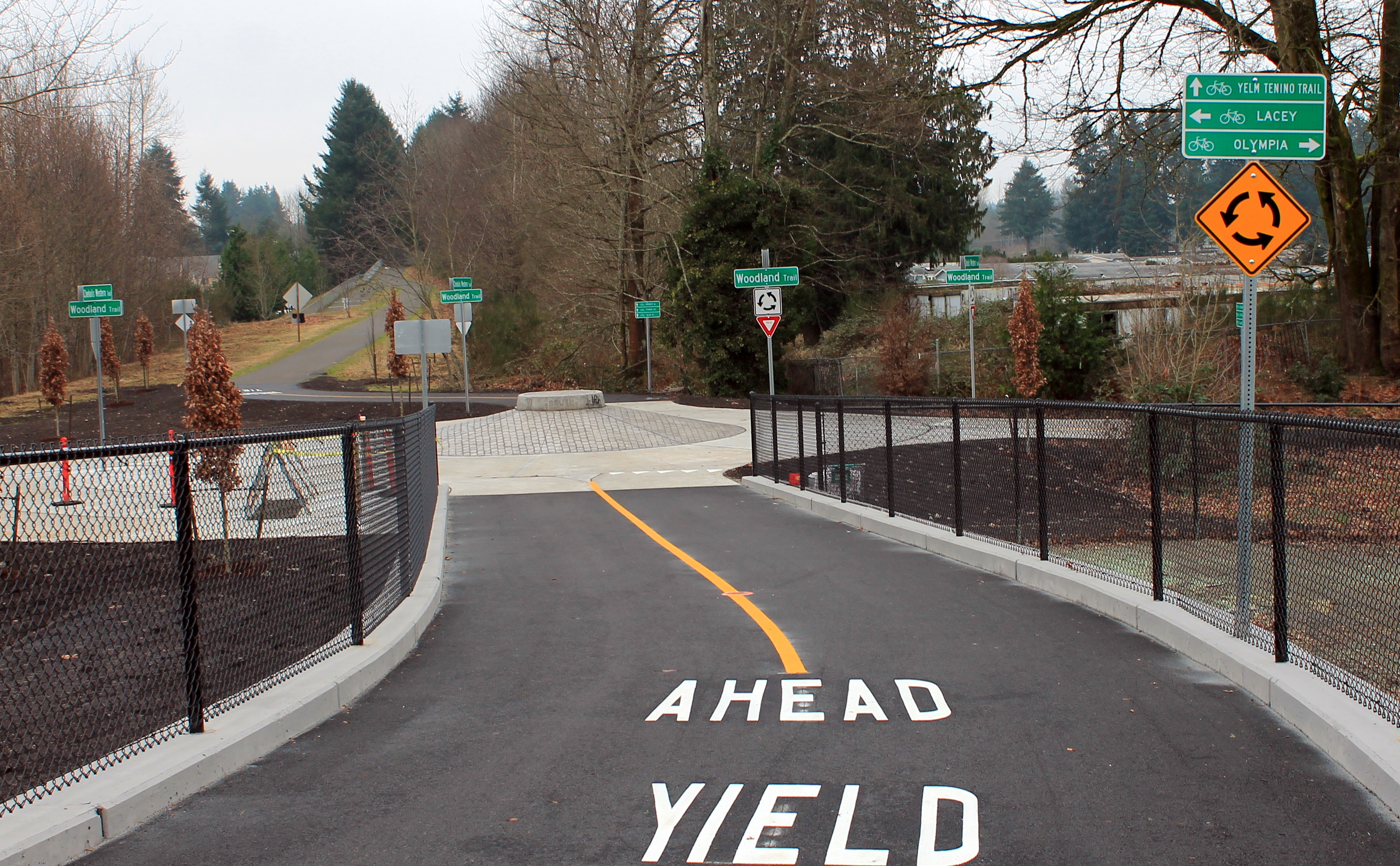
A round-about marks the junction of two trails in Lacey
Although the trail was acquired from the railroad in the late 1980s and early 1990s, road crossings at Martin Way, Interstate 5 and Pacific Avenue sent bicyclists and other trail users onto the streets and sidewalks for detours for many years.
The entire project to build three bridges on less than a mile-long section of trail cost about $8.4 million, which shows that elected officials in the area are dedicated to this trail.
The first bridge spanned Interstate 5 in 2007. The second bridge passed above Martin Way.
Construction on the third bridge over Pacific Avenue started in December 2013. It was finished about 3 months ahead of time.
It not only flies over the busy four-lane street, but connects with the east-west Woodland Trail at a “traffic circle” at the south landfall. That Woodland Trail heads toward Olympia, about 3 miles away.
Completing this bridge makes this popular trail even better and improves the overall 48-mile trail network in Thurston County.
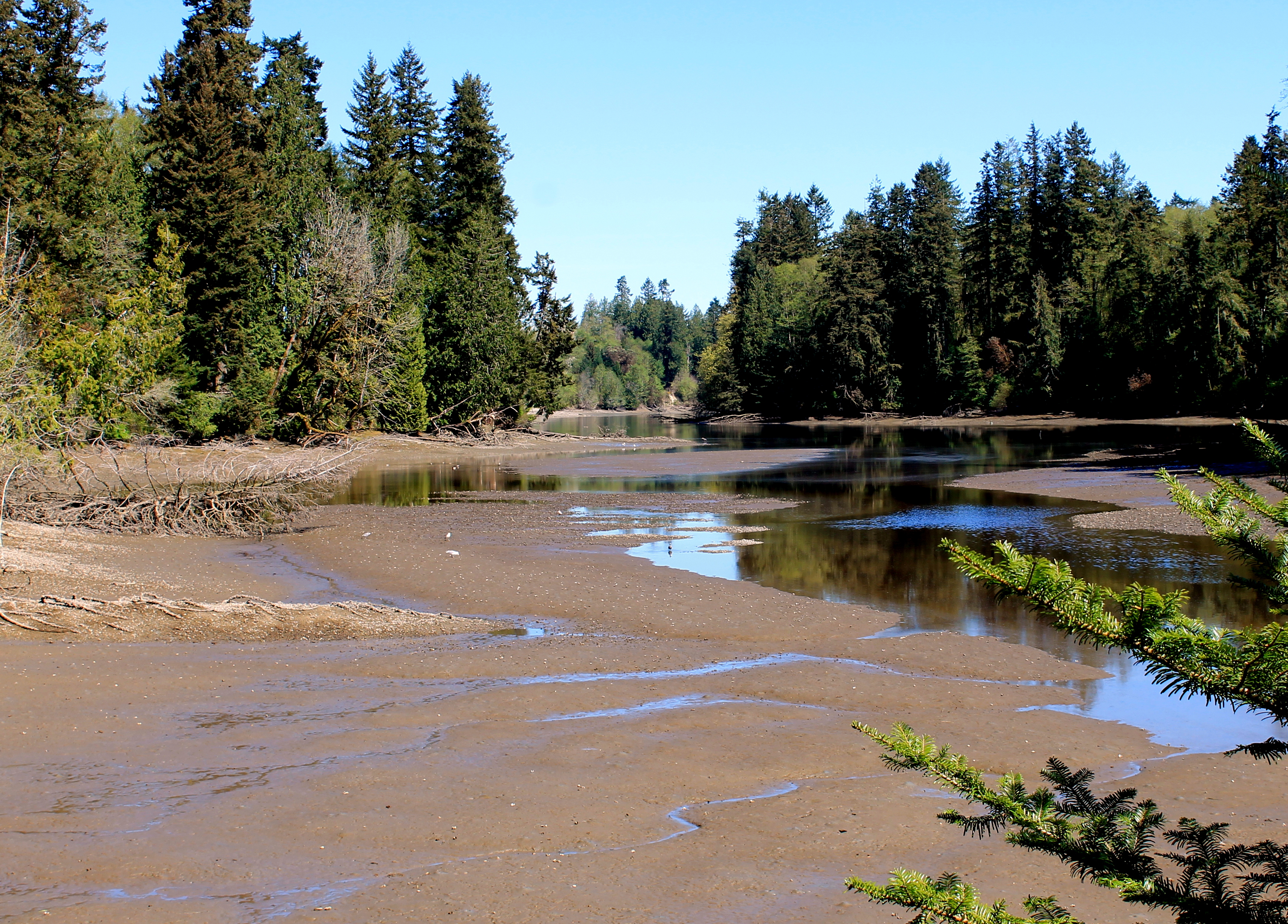
Early spring view of Woodard Bay. File photo
For visitors, the 3 or 4 mile stretch around Lacey is the busiest part of the trail. Heading north, the trail passes several ponds, pastures and wooded lots to the scenic overlooks at Woodard Bay Natural Area. Heading south from Lacey, the trail enters a remote area and passes the Deschutes River.
At the junction with the 14.5-mile Yelm-Tenino Trail, a left turn takes travelers to the town of Rainier in a short distance. They’ll find food and rest stops here.
2 comments
This is good news.
I’m assuming that the quarter mile detour around the active railgrade on Rainier Rd SE at the very southern border of Lacey is still in place?
Author
You are correct. There’s still that section of dirt trail along the railroad right-of-way. Haven’t heard any plans about that.